
Wireless Monitoring Reduces River Discharge Measurement Costs by 75% via Satellite Synchronization
The UK Environment Agency resolved technical challenges and heavy costs associated with cross-river cabling by implementing a wireless sensing system synchronized with satellite technology. This innovation not only reduced installation costs by up to 75%, but also enabled a fully off-grid monitoring operation on the River Ouse by incorporating solar power systems.
This content is a translation and analysis based on an article by Sucithra Mani, Media Editor at Induportals.
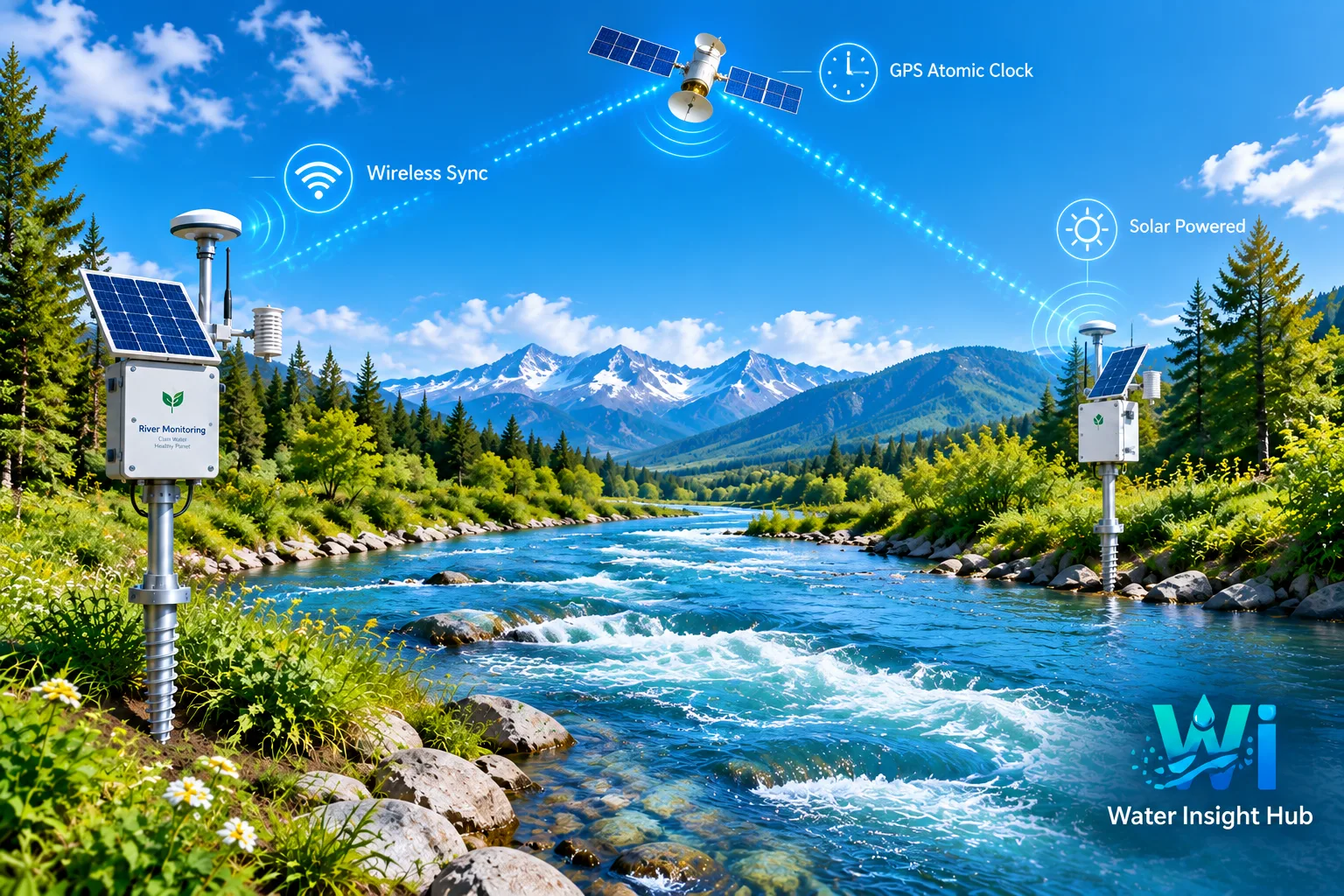
The UK Environment Agency replaced traditional transit-time systems with wireless sensing technology synchronized with GPS satellite atomic clocks.
According to Environment Agency data, the installation cost of the wireless system was estimated at approximately 25% of traditional ground-ducted methods.
Relying on solar energy and ground screw foundations, the project created a fully off-grid, ecologically compatible hydrometric station for the first time.
The UK Environment Agency (EA) uses river flow and discharge measurements for flood warning, hydrological modeling, flow forecasting, water infrastructure management, and abstraction licensing. The agency’s monitoring network comprises approximately 7,000 hydrometric stations across England, providing high-resolution data on river flow, water levels, groundwater, and precipitation.
At Barcombe Mills in East Sussex, the agency needed to replace an out-of-service transit-time flow monitoring system that had operated for years at the River Ouse site. The replacement system had to maintain accurate continuous flow measurements while avoiding heavy civil works and environmental impacts associated with replacing the cross-river cable duct.
Limitations of Traditional Transit-Time Monitoring
The transit-time method calculates flow velocity in rivers by measuring the time difference of acoustic sound waves traveling upstream and downstream. Sensors deployed on opposing riverbanks provide a complete velocity profile and continuous discharge measurements.
While used by the Environment Agency for decades, the method’s high temporal precision traditionally required connecting sensors on both banks via physical cabling across the riverbed. At Barcombe Mills, the previous installation utilized a duct embedded in the riverbed secured with earthenware chimney pots.
Replacing the underwater conduit required substantial construction operations and raised significant environmental concerns. Tunneling beneath the river was deemed completely impractical due to exorbitant costs and proximity to the reservoir dam.
Wireless Synchronization Replaces Cross-River Cabling
NIVUS supplied its Wireless Transit Time (WTT) system for this replacement project. The system maintains the physical principle of acoustic transit-time measurement while executing data exchange between sensors via wireless communication.
Transmitter and receiver timing is synchronized using GPS satellites equipped with precision atomic clocks. This technology provides the precise timing required to calculate signal transmission time differences upstream and downstream without physical cross-river cabling.
This approach eliminates invasive construction in natural environments. Bankside equipment can be secured using ground screws instead of concrete foundations, and the system can run entirely on solar energy, enabling off-grid operation and simplifying future decommissioning.
Reusing existing sensors reduced the demand for new hardware. The River Ouse width at Barcombe Mills is approximately 20 meters. The previous installation featured two sensor arrays mounted on underwater frames on both riverbanks, creating eight acoustic signal paths.
The existing submerged sensors were integrated into the new WTT system. This technical compatibility reduced the required volume of new equipment and directly lowered final installation costs. According to Environment Agency calculations, the estimated cost of the wireless system was about 25% of a full installation requiring riverbed ducting and piping. Thus, the wireless approach delivered a complete replacement for the aging system without incurring prohibitive civil construction costs or damaging the riverbed ecosystem.
Solar-Powered Monitoring at Barcombe Mills
The deployment at Barcombe Mills represents the first fully solar-powered WTT system implemented by the UK Environment Agency. Two other NIVUS WTT-based installations previously executed by the agency in North London and Yorkshire rely on mains grid electricity.
Utilizing solar panels eliminated the need for grid power connection at this remote location. The combination of wireless telemetry, ground screw foundations, and solar power established an off-grid configuration with minimal permanent structures.
The Barcombe Mills project forms part of the Environment Agency’s broader evaluation of wireless transit-time technologies. The agency is assessing the replacement of aging cabled systems with modern wireless variants at the end of their operational lifespans. This practical application demonstrates how satellite-based time synchronization can resolve key barriers to deploying conventional river hydrometric systems. For monitoring stations where installing riverbed cross-ducts is expensive, engineering-wise challenging, or ecologically incompatible, the wireless configuration offers an efficient alternative while preserving high acoustic measurement accuracy.
Exclusive Analysis by the Water Insight Hub Team
The evolution of river discharge measurement tools and surface water data acquisition marks a fundamental paradigm shift in water technologies toward semi-autonomous systems. Historically, monitoring open channels with high-precision methods like acoustic transit-time was inextricably linked with destructive geotechnical challenges and bed ecosystem disruption. The UK experience in replacing bed-laid cables with atomic-clock-equipped GPS satellites underscores a critical premise: monitoring infrastructure must not itself become an environmental hazard. From a global perspective, the convergence of acoustic sensing and space-based technology represents a foundational step toward real-time data networks for integrated river basin management.
In connection with telemetry advancement and remote sensing development, eliminating physical links between monitoring stations opens a new chapter in enhancing equipment resilience during flood events. As highlighted in the case study, using ground screws and solar PV at Barcombe Mills yielded a completely off-grid station that reduced deployment costs to 25% of traditional duct-based systems. This accomplishment stands as a classic engineering value benchmark, where retrofitting existing submerged transducers alongside a wireless architecture delivered dual benefits of economic optimization and technical stability.
From the Middle East and North Africa (MENA) perspective, implementing resilient, off-grid monitoring infrastructure is a imperative prerequisite for managing flash floods and recurring drought cycles. Ephemeral rivers and wadis across the MENA region experience powerful flows bearing heavy sediment loads during flash floods, which routinely sever or bury conventional bed-laid cabling. The wireless setup provided by NIVUS, powered by solar energy, responds directly to arid region requirements where grid access is limited and channel erosion is severe. Combined with digital transformation trends, integrating wireless sensing with Internet of Things (IoT) platforms can tangibly enhance dam and conveyance infrastructure resilience across MENA.
This technical milestone also offers valuable operational insights for broader regional water resource management. Hydrometric networks across key basins require high data continuity. Reliance on accurate real-time discharge figures serves as the backbone for optimal reservoir operation. Deploying or adapting satellite-synchronized wireless hydrometric setups removes heavy post-flood civil repair expenditures while ensuring water balance accuracy across river basins without imposing new financial burdens.
Looking ahead, integrating wireless hydrometric instruments with cloud computing and artificial intelligence completes the hydrological data value chain. Data streams generated from multi-path acoustic profiles can seamlessly feed hydrodynamic modeling platforms without latency. Ultimately, the transition from legacy cable-dependent monitoring to satellite-synchronized wireless infrastructure signals a clear direction for the water sector, where data-centric design, minimized physical footprint, and capital optimization guide sustainable management practices.
 Official Email of the Water Insight Hub: